When you plan a road trip through Arkansas, the Pig Trail stands out for good reason. This drive feels slower, quieter, and more personal than most scenic routes. You aren’t racing to a destination. You are settling into the road and its surrounding landscape.
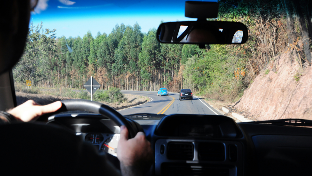
The Pig Trail cuts through the Ozark Mountains and rewards drivers who value attention and patience. Sharp turns, elevation changes, and forest cover keep you engaged. This isn’t a background drive; it asks you to stay present.
If you enjoy routes where the road shapes the experience, this stretch belongs on your list. With the right timing and preparation, the Pig Trail becomes more than a drive. It becomes the highlight of your trip. That sense of focus begins with the road itself.
What Makes the Pig Trail a True Scenic Standout
The Pig Trail follows Arkansas Highway 23 through the heart of the Ozark Mountains. The route covers about 19 miles, yet it feels longer due to sharp curves, steep grades, and narrow shoulders.
You remain engaged the entire time, adjusting speed and position as the terrain shifts. According to the Encyclopedia of Arkansas, this stretch runs between Fayetteville and Ozark, linking State Highway 16 with U.S. Highway 64 and cutting through the Ozark National Forest near the Mulberry River.
Dense forest lines both sides, keeping development minimal and the mountain setting intact. The road’s design adds to its character. Large portions were paved by 1936 using early road treatments, long before modern highway expansion. Unlike nearby interstates, the Pig Trail remained narrow and curving.
This characteristic preserved its original structure and led to its designation as a National Forest Scenic Byway in 1989. Seasonal changes heighten the experience. You’ll see layered reds and golds in the fall, while spring offers fresh growth and cooler air.
The Pig Trail feels intentional, shaped by history, terrain, and restraint rather than speed or convenience. This blend of preserved design and natural setting makes the drive more than scenic; it makes it memorable.
When Scenic Drives Connect to Real Road Risks
Most travelers reach the Pig Trail using larger highways. Interstate 49 is a primary route through Rogers and nearby cities. This transition from open interstate to mountain road deserves attention, as traffic conditions can change quickly in this area.
According to the NWA Homepage, a three-vehicle crash on southbound I-49 near Exit 82 by Pinnacle Hills Promenade occurred in December 2025. The collision slowed traffic to a crawl and resulted in two people being taken to the hospital, based on Arkansas State Police details shared through iDrive Arkansas.
Instances like this show how easily a routine drive can change. You may be focused on reaching a scenic destination, but the interstate still requires full awareness. When an unexpected crash creates confusion or injury during your ride, guidance matters.
Speaking with a Rogers car accident lawyer can help you understand what steps make sense in that moment. Clear information often reduces stress when decisions feel overwhelming.
According to Keith Law Group, understanding the legal process is often key to pursuing appropriate compensation after a crash. With those details handled, you can return your focus to the road and the drive ahead.
Once you exit the interstate, the pace slows. Still, caution remains vital. The Pig Trail requires controlled speed, steady focus, and respect for limited visibility.
Exploring the Outdoors Beyond the Road
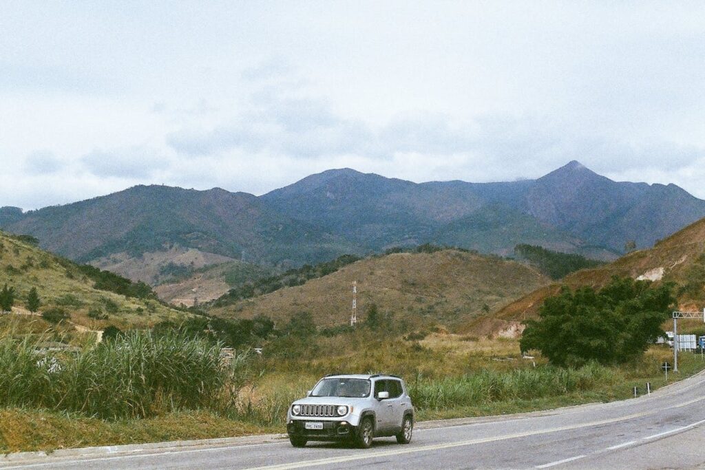
The Pig Trail doesn’t exist in isolation. It connects you to some of northwest Arkansas’s most rewarding outdoor areas. Planning stops beyond the drive adds depth to your trip.
Several hiking trails sit within a short distance of Highway 23, making it easy to combine driving with time on foot. Finding NWA highlights several fall-view hikes near the Pig Trail. These include Sam’s Throne, Tanyard Creek Loop, and the Lake Loop Trail at Lincoln Lake.
Other popular options include Yellow Rock, Alum Cove Natural Bridge Trail, Pedestal Rocks Loop at Kings Bluff, and Whitaker Point. These trails vary in length and difficulty, but each offers elevated views, rock formations, or waterfalls that peak during the fall color season.
Water access points also appear near the route. Small pull-offs lead to creeks and river edges where you can find quiet places to rest. These stops help break the drive into manageable segments. Fall remains the most popular season for combining driving and hiking.
Cooler air and stable weather make outdoor movement easier. If you plan wisely, you can drive in the morning and hike midday. The Pig Trail works best when you treat it as a hub, not a single task.
How to Plan the Drive for the Best Experience
Timing and preparation shape how much you enjoy the Pig Trail. Fall offers peak color, but spring delivers cooler temperatures and fewer crowds. Summer works best early in the day.
NWA Daily highlights six scenic drives for fall foliage across Arkansas. These include the Pig Trail Scenic Byway and AR-43 through Boxley Valley, which opens into wide pastoral views. The list also mentions AR-7 past the Arkansas Grand Canyon, which features long bluff overlooks.
Likewise, the AR-170 to Devil’s Den stands out for steep elevation changes, while the US-71 to Artist Point provides distant mountain views. Finally, AR-12 to War Eagle Mill follows rivers and historic stops. These routes vary in layout and pace, but all reward careful planning.
Before you enter the forest, check your vehicle. Brakes, tires, and steering matter on continuous curves. Download maps ahead of time since cell service drops in areas. Pack water, basic tools, and weather layers. Conditions can change quickly in the mountains. Use headlights during the day for added visibility.
Watch for motorcycles, cyclists, and wildlife. Many use the road for the same reasons you do. Respect speed limits and avoid rushing. Good planning lets you enjoy the drive without added stress.
People Also Ask
1. How long does it take to drive the entire Pig Trail?
Driving the nineteen-mile stretch usually takes about forty-five minutes to an hour. However, most travelers spend half a day here to enjoy scenic pull-offs and photography. Since the road is narrow and winding, maintaining a slow, steady pace is much safer than trying to rush through the forest.
2. Is the Arkansas Pig Trail safe for motorcycles and large RVs?
The trail is a favorite for motorcyclists but requires advanced skills due to sharp switchbacks. Large RVs should exercise extreme caution; the tight curves and overhanging trees can be difficult for long vehicles to navigate. It is often better to use a smaller car to fully appreciate the technical route.
3. What is the significance of the Turner Bend Store “Survivor” patch?
For decades, the Turner Bend Store has sold a famous “I Survived the Pig Trail” patch. It serves as a badge of honor for motorcyclists and drivers who successfully navigate the sharp switchbacks. Visiting this historic general store allows you to grab a snack and join a long-standing travel tradition.
The Pig Trail earns its place on your bucket list through focus and restraint. It offers scenery without excess and challenge without chaos. Every mile keeps you engaged. By preparing for highway travel, planning outdoor stops, and driving with care, you protect the experience.
This road rewards attention and patience. If you value trips that feel grounded and memorable, the Pig Trail delivers. It isn’t about getting there fast. It’s about enjoying every turn along the way.